Satelyzer - Satellite Data Service for Agriculture
I. GENERAL SITUATION
The growing demand to increase efficiency in agriculture requires comprehensive analysis of data in the relevant field and the application of modern technologies when assessing the results.
Problem:
- Inadequate assessment and analysis of fields;
- Challenges in forecasting and planning;
- Additional resources and costs required for the analysis and monitoring of agricultural fields;
- Decreased efficiency.
Solution: Detailed analysis of agricultural lands using satellite imagery.
II. BRIEF DESCRIPTION
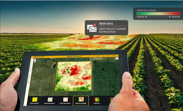
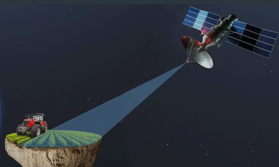
- Satelyzer processes data related to agricultural lands using satellite imagery.
- Application areas:
- Agricultural lands owned by farmers;
- State-owned and large corporate agricultural lands;
- Forests (services related to forest protection).
- It consists of two parts:
- Online user panel;
- Data obtained via remote sensing.
- Key Features/Advantages:
- Provides farmers and agronomists with precise information for monitoring crop fields, more efficient resource management (determining optimal times for irrigation, fertilization, and harvesting, weather forecasting, soil health, moisture level detection, etc.), and increasing productivity.